Creating terrain files with L3DT for Opensim
As i was in the process of updating the rather old informations about creating terrain files with L3Dt on the opensim Wiki [ Link ] i thought why not doing another blog post about the whole process.
So i repeat the basic steps for creating a nice random terrain with L3DT
– Download the latest version of the free L3DT Standard Edition – v13.01 dev build 0
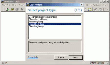
01. Start L3DT and create a NEW MAP by clicking on that + icon in the menu bar and select Fractal Heightmap and click the next button.
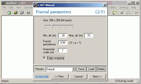
02. Set the size to 256×256 and choose your terrains minimum and maximum altitude (20 is the waterline in opensim; Higher values for the maximum results in high mountains). So for a start and to get hills and riffs use values like -20 as minimum and 70 as the maximum altitude. Set the Horizontal scale to 1 (important) and check the “Edge wrapping” option and click the Next Button
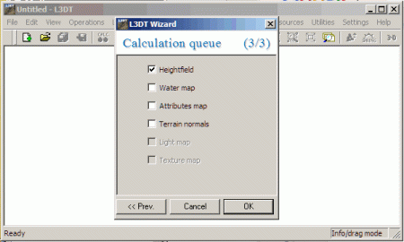
03. In the calculation queue (step 3 of 3) only select the Heightfield. (Selecting the other options like Water map gives you a nicer view in L3DT build in Preview but will not be used for opensim.)
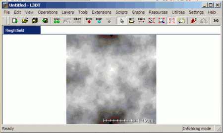
Now the calculation of your terrain starts and you will be presented with a grayscale picture of your heightmap.
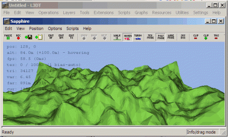
If you want to see how the terrain looks, click the 3-D Button in the menu bar. You can look/move around with the in the 3D preview (Hold the left mouse button to cam around). To get out of the 3D preview just hit the ESC key.
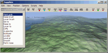
If you like to make adjustments to this map , click on the EDIT button in the menu bar. You get some opensim like land tools for creating hills or cliffs or you can lower or elevate parts of your map.
If you are done with your changes hit the ESC key again to proceed with the map export.
Now for the export
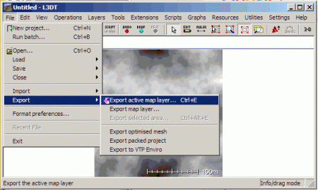
Choose FILE / EXPORT / EXPORT ACTIVE LAYER MAP (STRG +E) or use the corresponding icon in the menu bar.
Now select R32 in the File Format Dropdown… 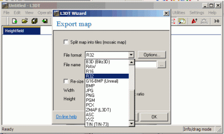
and name the terrain file whatever you want, and click OK to save it …. or click the .. button to select a directory where your maps should be saved.
After you clicked the OK Button you are finished and ready to upload that terrain file to your simulator.
To load the terrain into opensim:
Assume your file is called “terrain.r32”.At the region console, type:
change region yourregionname
terrain load terrain.r32
You now have your new terrain! You can at this point use the terrain add, terrain scale, or terrain multiply commands in the opensim console to rescale it to your liking. [Link]
i will soon publish a new blog post with more advanced methods of creating terrain files.
Hope you liked this little tutorial to get you started with L3DT ..
[…] – Avui hem pogut llegir l’article Creating terrain files with L3DT for Opensim, una guia actualitzada de com generar arxius de terreny per a […]
Educació i móns virtuals » Genera terrenys amb L3DT - February 6, 2013 at 23:25 |
[…] As i was in the process of updating the rather old informations about creating terrain files with L3Dt on the opensim Wiki [ Link ] i thought why not doing another blog post about the whole proces… […]
Creating terrain files with L3DT for Opensim | Logicamp | Scoop.it - February 7, 2013 at 07:47 |
[…] See on myosgrid.wordpress.com […]
Logicamp » Creating terrain files with L3DT for Opensim » Logicamp - February 7, 2013 at 07:48 |
[…] As i was in the process of updating the rather old informations about creating terrain files with L3Dt on the opensim Wiki [ Link ] i thought why not doing another blog post about the whole proces… […]
Creating terrain files with L3DT for Opensim | ... - April 15, 2013 at 22:45 |